NASA releases clearest images of Pluto the world has never seen

These are the best images of Pluto you’ll see in your lifetime

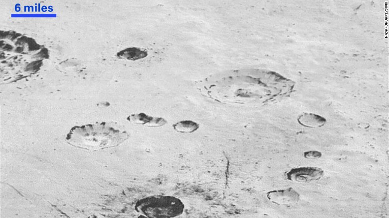
In what seems to be the end of the year gift for star gazers, astronomers and hobbyists, NASA on Friday released the highest resolution images of Pluto. The images released by NASA show Pluto’s varied terrain with a resolution of 77 to 85 meters per pixel and are perhaps, the best we would be seeing in our lifetime.

NASA has released the clearest images yet of the surface of Pluto. This photo shows the the mountainous shoreline of Sputnik Planum. "The mountains bordering Sputnik Planum are absolutely stunning at this resolution," said New Horizons science team member John Spencer of the Southwest Research Institute. <a href="https://www.nasa.gov/image-feature/the-mountainous-shoreline-of-sputnik-planum" target="_blank">Read full caption.</a>

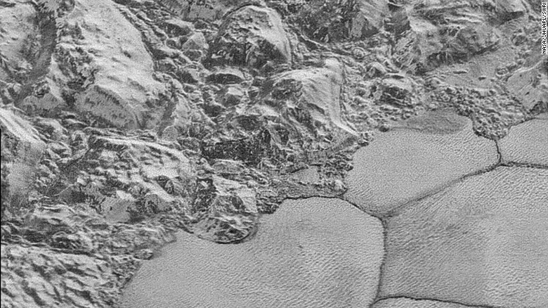
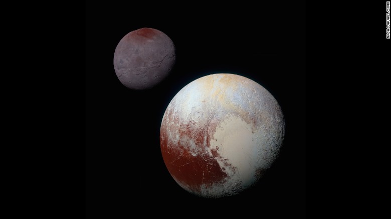
The images, taken by NASA’s New Horizons spacecraft, show craters, mountains and glacial terrain along a strip 50 miles (80 kilometers) wide.  The spacecraft took them in July during its closest flyby of Pluto — which is at a distance from Earth that varies from 4.67 billion miles (7.5 billion kilometers) to 2.66 billion miles (4.28 billion kilometers) — and they were among the most recent batch sent to back to our planet.

This image shows the layered interior walls of the planet's many craters. According to NASA, "layers in geology usually mean an important change in composition or event." However, NASA says the New Horizons team members do not know if they are seeing local, regional or global layering.<br />Most of the craters seen here lie within the 155-mile (250-kilometer)-wide Burney Basin. <a href="https://www.nasa.gov/image-feature/plutos-layered-craters-and-icy-plains" target="_blank">Read full caption.</a>

This image shows how erosion and faulting has sculpted Pluto's icy crust into rugged badlands. The prominent 1.2-mile-high cliff at the top is part of a great canyon system that stretches for hundreds of miles across Pluto's northern hemisphere, NASA says. <a href="https://www.nasa.gov/image-feature/pluto-s-badlands" target="_blank">Read full caption.</a>

<a href="https://www.nasa.gov/feature/pluto-s-big-moon-charon-reveals-a-colorful-and-violent-history" target="_blank">Pluto's largest moon, Charon</a>, in seen in enhanced color in this image taken by NASA's New Horizons spacecraft. The space probe took the image just before it made its closest approach on July 14, 2015. The image combines blue, red and infrared images to best highlight the moon's surface features. Charon is 754 miles (1,214 kilometers) across. The image was released on October 1, 2015.

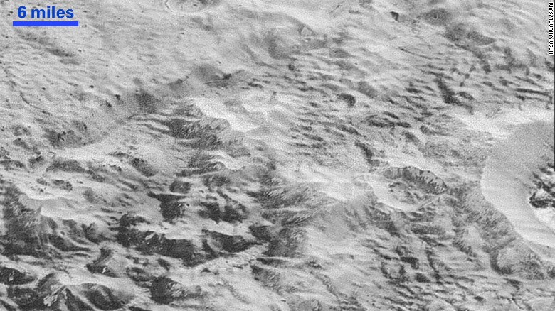
The higher resolution photos will allow scientists to better understand Pluto’s puzzling geology, which has surprised with an active surface that indicates the presence of interior heating.

<a href="https://www.nasa.gov/feature/pluto-s-big-moon-charon-reveals-a-colorful-and-violent-history" target="_blank">This composite of enhanced color images</a> shows the striking differences between Pluto (lower right) and its largest moon, Charon (upper left). NASA says the color and brightness of the two worlds have been processed identically to allow for direct comparison. Pluto and Charon are shown with approximately correct relative sizes, but their true separation is not to scale.

“New Horizons thrilled us during the July flyby with the first close images of Pluto, and as the spacecraft transmits the treasure trove of images in its onboard memory back to us, we continue to be amazed by what we see,” said John Grunsfeld, a former astronaut and the associate administrator for NASA’s Science Mission Directorate.

Subscribe to our newsletter

To be updated with all the latest news

1 COMMENT

LEAVE A REPLY

Please enter your comment!
Please enter your name here

Subscribe to our newsletter

To be updated with all the latest news

Read More

Suggested Post